
Things moved along through the early morning quiet in Carlsbad Village to the coast, and a brief stop at the beach gave me a chance to capture my trusty XO-2 with another scenic background.

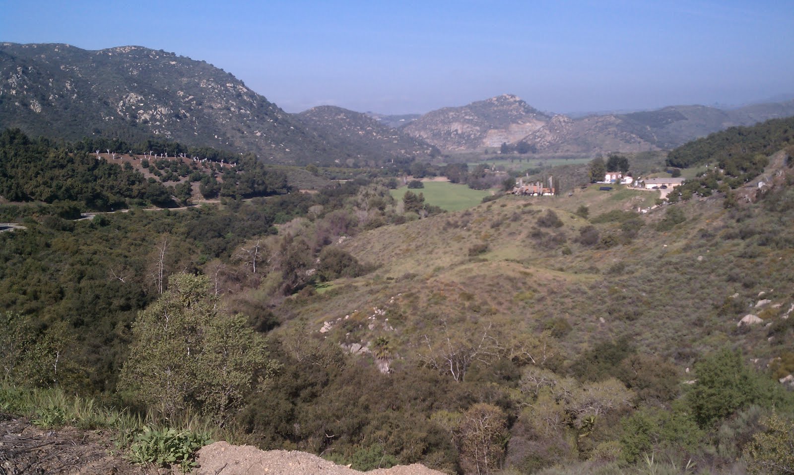
In those early morning hours, with auto traffic light but with the frequent company of others running and walking in the calm of the early day, despite the chill, I reaped the reward of my early rise and departure. Further on down the coast route, just past Palomar Airport Road, there's one of my favorite places to survey the coastline, and this is how it looked that last morning of February:

There's this guy who drives a perfect condition, mid-70s Datsun B-210 on the coast route, and he parks it in places tempting for me to photograph. Unfortunately, he's always sitting in the car, so I haven't snapped a pic yet. Next time I see him, however, I'm banging on his window and getting permission. That car takes me way back.
In the meantime, here's a car that parks at the Encinitas Coaster Station nearly every dang day...and in a way that seems to make some sort of statement:

However, at the end of the week, I thought I'd try something different. However, what I did was different, but unintended: I lost my keys. Along with them, I lost my sense of confidence in venturing away from home, and my plans for a weekend ride in the country went astray. Fortunately, my commute, due to its length, forces one to stay in touch with their inner adventurer, and after a week of successfully commuting without losing any additional keys, and a Saturday spent watching a locksmith restore my access to my mailbox (at a princely sum!), I was truly ready for something different.
That something different was to go on a bike ride that didn't involve a train station or a place of employment, nor a bike that had a rack and mudguards. So, on a foggy Sunday, I set out to rediscover some favorite roads. Riding east, away from the coast, one finds that the terrain is quite different.

This descent comes at the end of Gopher Canyon Road, which is a fun ride except that the road has access to the I-15 freeway and many motorists use the road as a warm-up to driving at highway speed. Early Sunday morning is not so bad, however, but this signed descent sharply drops to not only where the road ends in a T at the bottom of the hill, but also where it crosses under I-15. Once one negotiates past the motorists itching to turn left in front of you, and makes the stop at the bottom of the hill, the ride really mellows out. Continuing east, one climbs Circle R Road, one of my favorite climbs, ascending or descending.

A canopy of live oaks is a fine sight, but mostly it's citrus and avocado groves here. Despite the agricultural nature of the groves, it is a relief from the palms and eucalyptus of the coast. Circle R summits, and meets West Lilac Road (which, this time of year, one finds appropriately named), passes Munster Platz (I had no idea they lived here!), then tees with Lilac Road. A minimal climb summits, and the real fun begins.
This descent is broken into three parts, and the first part on Lilac Road sets the tone. A steep drop into a series of left-right switchbacks on irregular pavement with no guardrails gets the party started, sending one down and finally bottoming out at the oak hollow at Keys Creek. Out of the hollow, the road rolls over a rise, then a dip, and then intersects with Couser Canyon Road. Immediately, the road shoots up with a steady and steep pace. It's only about a mile, but the summit has the circumstance that would allow a KOM banner, and the crossing leads to drinking, sunglasses mounted, and arm warmers (if in season) pulled up.
This second part is much like the first, fast right-left turns through citrus and avocado groves, then it empties out into an oak hollow. This hollow has a horse ranch on the right hand side, which is indicated by a life-size statue of a horse in the oaks. This statue does nothing but make the passing rider think that there is a loose horse next to the road, and since horses are startled by cyclists into either stepping into their path, or depositing a slippery, smelly, semi-solid substance onto the road, it's a little alarming to approach at 40mph. Still, once past that, the road is slightly downhill, and one can hammer a big gear through the hollow until a right-hand bend rises up to a left-hand corner which leads to the final third of the descent.
From there, its another winding, guardrail-less descent down to the San Luis Rey River valley. It's a great descent, allowing one to truly ride their bike, but one has to be aware of the avocados that dot the road--guacamole is slippery! The descent ends in an idyllic, pastoral landscape, and the last half mile to hwy 76 allows one to relax, stretch, and prepare for a change in scenery and tempo. I'll leave the description of the next portion to another time, but I did snap this pic...

I always thought that Thornton Wilder was writing about this Bridge of San Luis Rey. Sadly, he wasn't, but I still think there's a little literature in my weekend rides...
I love the light of dawn and the cool steel of the ocean in your morning photos.
ReplyDelete-k